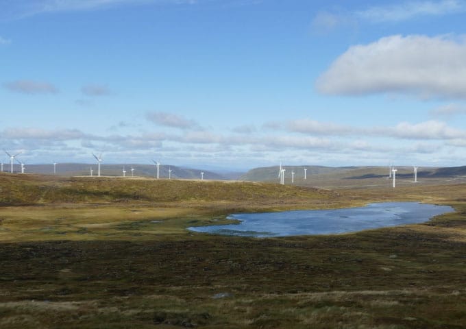
Applied Ecology was appointed by SSE Renewables to complete pre- and post-construction botanical monitoring at the 66 turbine Stronelairg wind farm, located at an elevation of 600 metres above sea level in the Monadhliath Mountain range, south-east of Fort Augustus in the Scottish Highlands.
During the wind farm consenting process concerns were raised that the development might displace deer from the wind farm site into the adjacent Monadhliath Special Area of Conservation (SAC), and increase grazing and trampling pressures which could lead to a deterioration in the condition of the SAC blanket bog habitat qualifying features.
Applied Ecology devised and executed a pre- and post-construction monitoring programme for the SAC designated land next to the wind farm. We set up a grid of fixed, permanently marked plant sampling quadrats which we have monitored to assess deer grazing effects. We recorded higher and lower plant cover within these quadrats, as well as other indicators of herbivory, such as deer dung and hoof prints. We used multivariate statistics to track changes in vegetation composition over time, and potential explanatory environmental variables for the trends identified. The survey area was incredibly remote, with physically demanding terrain, but presented a welcome opportunity to record high altitude plant species.
The post-construction data recorded lower levels of deer use on the parts of the SAC closest to the wind farm compared to levels of deer use that we recorded pre-construction. The reasons for this change could not be determined conclusively, but our observation was that deer appeared to be preferentially using the more sheltered environment provided by the wind farm than the more open bog and heath habitats within the SAC.